Weather Alert in New Mexico
Red Flag Warning issued February 16 at 1:49AM MST until February 17 at 7:00PM MST by NWS Albuquerque NM
AREAS AFFECTED: Northeast Plains; East Central Plains
DESCRIPTION: ...RED FLAG WARNING IN EFFECT FROM 11 AM TO 6 PM TODAY FOR THE NORTHEAST HIGHLANDS DUE TO STRONG WINDS AND LOW HUMIDITY... ...RED FLAG WARNING IN EFFECT FROM 10 AM TO 7 PM TUESDAY FOR THE NORTHEAST HIGHLANDS, NORTHEAST PLAINS, AND EAST-CENTRAL PLAINS DUE TO STRONG WINDS AND LOW HUMIDITY... .A storm system approaching from the west will allow southwest winds to increase today. This combined with relative humidity values in the low teens will result in critical fire weather conditions across parts of northeast NM this afternoon. Much stronger to damaging southwest to west winds will impact New Mexico Tuesday with critical fire weather over a larger area of eastern NM. Potential for peak wind gusts of 55 to 70 mph with minimum humidity values of 15 to 20% will allow for rapid fire spread among fine fuels. The National Weather Service in Albuquerque has issued a Red Flag Warning...which is in effect from 10 AM to 7 PM MST Tuesday. The Fire Weather Watch is no longer in effect. * AREA AND TIMING...Northeast Plains (Zone 104) and East-Central Plains (Zone 126) Tuesday. * 20 FOOT WINDS...Southwest to west 30 to 40 mph with peak gusts of 55 to 70 mph. * RELATIVE HUMIDITY...Minimum values of 14 to 21%. * IMPACTS...Any fires that develop will likely spread rapidly. Outdoor burning is not recommended.
INSTRUCTION: Please advise the appropriate officials or fire crews in the field of this Red Flag Warning.
Want more detail? Get the Complete 7 Day and Night Detailed Forecast!
Current U.S. National Radar--Current
The Current National Weather Radar is shown below with a UTC Time (subtract 5 hours from UTC to get Eastern Time).

National Weather Forecast--Current
The Current National Weather Forecast and National Weather Map are shown below.

National Weather Forecast for Tomorrow
Tomorrow National Weather Forecast and Tomorrow National Weather Map are show below.

North America Water Vapor (Moisture)
This map shows recent moisture content over North America. Bright and colored areas show high moisture (ie, clouds); brown indicates very little moisture present; black indicates no moisture.

Weather Topic: What are Cumulus Clouds?
Home - Education - Cloud Types - Cumulus Clouds
 Next Topic: Drizzle
Cumulus clouds are fluffy and textured with rounded tops, and
may have flat bottoms. The border of a cumulus cloud
is clearly defined, and can have the appearance of cotton or cauliflower.
Cumulus clouds form at low altitudes (rarely above 2 km) but can grow very tall,
becoming cumulus congestus and possibly the even taller cumulonimbus clouds.
When cumulus clouds become taller, they have a greater chance of producing precipitation.
Next Topic: Drizzle
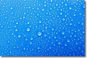
Weather Topic: What is Evaporation?
Home - Education - Precipitation - Evaporation
 Next Topic: Fog
Evaporation is the process which returns water from the earth
back to the atmosphere, and is another crucial process in the water cycle.
Evaporation is the transformation of liquid into gas, and it happens because
molecules are excited by the application of energy and turn into vapor.
In order for water to evaporate it has to be on the surface of a body of water.
Next Topic: Fog
Current conditions powered by WeatherAPI.com


