Weather Alert in Montana
Winter Weather Advisory issued February 18 at 10:54PM MST until February 19 at 6:00AM MST by NWS Great Falls MT
AREAS AFFECTED: Western and Central Chouteau County; Judith Basin County and Judith Gap; Fergus County below 4500ft; Snowy and Judith Mountains
DESCRIPTION: * WHAT...Snow. Additional snow accumulations up to two inches. * WHERE...Snowy and Judith Mountains, Fergus County below 4500ft, Judith Basin County and Judith Gap, and Western and Central Chouteau County. * WHEN...Until 6 AM MST Thursday. * IMPACTS...Plan on slippery road conditions. * ADDITIONAL DETAILS...Snow develops from southwest to northeast this evening, with the heaviest snow expected between now and 3 AM.
INSTRUCTION: Slow down and use caution while traveling. The latest road conditions can be obtained by calling 5 1 1 or visiting the MDT Road Report website. To see a graphical representation of the degree of stress on young livestock please visit our webpage and select Local Programs then Cold Air Advisory for Newborn Livestock.
Want more detail? Get the Complete 7 Day and Night Detailed Forecast!
Current U.S. National Radar--Current
The Current National Weather Radar is shown below with a UTC Time (subtract 5 hours from UTC to get Eastern Time).

National Weather Forecast--Current
The Current National Weather Forecast and National Weather Map are shown below.

National Weather Forecast for Tomorrow
Tomorrow National Weather Forecast and Tomorrow National Weather Map are show below.

North America Water Vapor (Moisture)
This map shows recent moisture content over North America. Bright and colored areas show high moisture (ie, clouds); brown indicates very little moisture present; black indicates no moisture.

Weather Topic: What are Cumulus Clouds?
Home - Education - Cloud Types - Cumulus Clouds
 Next Topic: Drizzle
Cumulus clouds are fluffy and textured with rounded tops, and
may have flat bottoms. The border of a cumulus cloud
is clearly defined, and can have the appearance of cotton or cauliflower.
Cumulus clouds form at low altitudes (rarely above 2 km) but can grow very tall,
becoming cumulus congestus and possibly the even taller cumulonimbus clouds.
When cumulus clouds become taller, they have a greater chance of producing precipitation.
Next Topic: Drizzle
Weather Topic: What is Evaporation?
Home - Education - Precipitation - Evaporation
 Next Topic: Fog
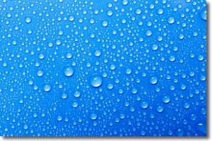
Evaporation is the process which returns water from the earth
back to the atmosphere, and is another crucial process in the water cycle.
Evaporation is the transformation of liquid into gas, and it happens because
molecules are excited by the application of energy and turn into vapor.
In order for water to evaporate it has to be on the surface of a body of water.
Next Topic: Fog
Current conditions powered by WeatherAPI.com


