Weather Alert in Oregon
Flash Flood Watch issued August 26 at 12:30PM PDT until August 27 at 5:00AM PDT by NWS Boise ID
AREAS AFFECTED: Harney County
DESCRIPTION: A surge of deep monsoonal moisture combined with a slow-moving upper trough will bring periods of heavy showers and thunderstorms across the region. This airmass contains anomalously high moisture content, supporting the potential for excessive rainfall. Flash flooding will be possible, especially in steep terrain, narrow canyons, and near recent burn scars where soils are less able to absorb rainfall. The greatest risk will be Tuesday afternoon through Wednesday evening as repeated rounds of storms move through. * WHAT...Flash flooding caused by excessive rainfall continues to be possible. * WHERE...A portion of southeast Oregon, including the following county, Harney County. * WHEN...Through late tonight. * IMPACTS...Heavy rainfall could trigger flash flooding or debris flows, especially in and near recent wildfire burn scars. * ADDITIONAL DETAILS... - https://www.weather.gov/safety/flood
INSTRUCTION: You should monitor later forecasts and be prepared to take action should Flash Flood Warnings be issued. Local emergency services are monitoring the situation and will issue a public statement as conditions warrant. PLAN NOW so you will know what to do in an emergency. Keep informed by listening to local radio and television for statements and possible warnings. Follow the advice of public safety officials.
Want more detail? Get the Complete 7 Day and Night Detailed Forecast!
Current U.S. National Radar--Current
The Current National Weather Radar is shown below with a UTC Time (subtract 5 hours from UTC to get Eastern Time).

National Weather Forecast--Current
The Current National Weather Forecast and National Weather Map are shown below.

National Weather Forecast for Tomorrow
Tomorrow National Weather Forecast and Tomorrow National Weather Map are show below.

North America Water Vapor (Moisture)
This map shows recent moisture content over North America. Bright and colored areas show high moisture (ie, clouds); brown indicates very little moisture present; black indicates no moisture.

Weather Topic: What are Cumulus Clouds?
Home - Education - Cloud Types - Cumulus Clouds
 Next Topic: Drizzle
Cumulus clouds are fluffy and textured with rounded tops, and
may have flat bottoms. The border of a cumulus cloud
is clearly defined, and can have the appearance of cotton or cauliflower.
Cumulus clouds form at low altitudes (rarely above 2 km) but can grow very tall,
becoming cumulus congestus and possibly the even taller cumulonimbus clouds.
When cumulus clouds become taller, they have a greater chance of producing precipitation.
Next Topic: Drizzle
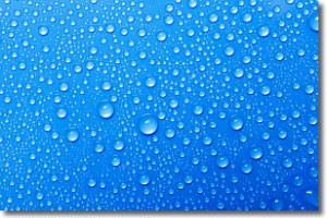
Weather Topic: What is Evaporation?
Home - Education - Precipitation - Evaporation
 Next Topic: Fog
Evaporation is the process which returns water from the earth
back to the atmosphere, and is another crucial process in the water cycle.
Evaporation is the transformation of liquid into gas, and it happens because
molecules are excited by the application of energy and turn into vapor.
In order for water to evaporate it has to be on the surface of a body of water.
Next Topic: Fog
Current conditions powered by WeatherAPI.com


