Weather Alert in Maine
Air Quality Alert issued July 16 at 9:33AM EDT by NWS Caribou ME
AREAS AFFECTED: Northwest Aroostook; Northeast Aroostook; Northern Somerset; Northern Piscataquis; Northern Penobscot; Southeast Aroostook; Central Piscataquis; Central Penobscot; Southern Piscataquis; Northern Washington
DESCRIPTION: The Maine Department of Environmental Protection's Bureau of Air Quality has issued an Air Quality Alert for particle pollution until midnight EDT tonight. Particle pollution levels are expected to rise into the Unhealthy for Sensitive Groups range on Tuesday. Values are already in the USG range this morning. Smoke is currently expected to not move out of Maine until Thursday, though this denser portion of the plume should move out by Thursday. In addition, particle pollution levels are expected to be moderate for the remainder of the state while ozone level are expected in the moderate range for the Maine coastal regions. The Maine Department of Environmental Protection recommends that individuals consider limiting strenuous outdoor physical activity to reduce the risk of adverse health effects. People who may be especially sensitive to the effects of elevated levels of pollutants include the very young, the elderly, those with pre-existing respiratory problems such as asthma, those with heart disease and anyone who is working hard outdoors. But if you experience symptoms such as shortness of breath, coughing, throat irritation or an uncomfortable sensation in your chest please consider limiting the intensity and duration of your outdoor activities. A toll free air quality hotline has been established so Maine residents can stay informed on the air quality situations. The toll free number is: 1-800-223-1196. Additionally the Maine Department of Environmental Protection has the air quality forecast available on the web at www.maine.gov/dep/air/aqforecast.
INSTRUCTION: N/A
Want more detail? Get the Complete 7 Day and Night Detailed Forecast!
Current U.S. National Radar--Current
The Current National Weather Radar is shown below with a UTC Time (subtract 5 hours from UTC to get Eastern Time).

National Weather Forecast--Current
The Current National Weather Forecast and National Weather Map are shown below.

National Weather Forecast for Tomorrow
Tomorrow National Weather Forecast and Tomorrow National Weather Map are show below.

North America Water Vapor (Moisture)
This map shows recent moisture content over North America. Bright and colored areas show high moisture (ie, clouds); brown indicates very little moisture present; black indicates no moisture.

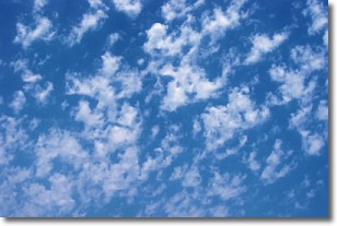
Weather Topic: What are Fractus Clouds?
Home - Education - Cloud Types - Fractus Clouds
 Next Topic: Freezing Rain
A fractus cloud (scud) is a fragmented, tattered cloud which has
likely been sheared off of another cloud. They are accessory clouds, meaning they
develop from parent clouds, and are named in a way which describes the original
cloud which contained them.
Fractus clouds which have originated from cumulus clouds are referred to as
cumulus fractus, while fractus clouds which have originated from stratus clouds
are referred to as stratus fractus. Under certain conditions a fractus cloud might
merge with another cloud, or develop into a cumulus cloud, but usually a
fractus cloud seen by itself will dissipate rapidly.
They are often observed on the leading and trailing edges of storm clouds,
and are a display of wind activity.
Next Topic: Freezing Rain
Weather Topic: What is Graupel?
Home - Education - Precipitation - Graupel
 Next Topic: Hail
Graupel is a form of precipitation that is created by atmospheric conditions
which cause supercooled water droplets to contact snow crystals and freeze to
their surface.
Sometimes known as soft hail or snow pellets, graupel is delicate and easily
destroyed by touch. Whereas hail usually falls during severe weather, graupel
doesn't require such conditions to form, and can form in mild precipitation
similar to situations which produce snowfall.
Next Topic: Hail
Current conditions powered by WeatherAPI.com


