Weather Alert in Alaska
Winter Storm Watch issued February 19 at 12:47AM AKST until February 22 at 3:00PM AKST by NWS Fairbanks AK
AREAS AFFECTED: Northern Seward Peninsula; Shishmaref; Bering Strait Coast; Southern Seward Peninsula Coast; Interior Seward Peninsula
DESCRIPTION: * WHAT...Blizzard conditions possible. Total snow accumulations between 4 and 8 inches possible. Winds could gust as high as 50 mph. * WHERE...Bering Strait Coast, Interior Seward Peninsula, Northern Seward Peninsula, Shishmaref, and Southern Seward Peninsula Coast. * WHEN...From late Friday night through Sunday afternoon. * IMPACTS...Visibilities may drop below 1/4 mile due to falling and blowing snow. Travel could be very difficult. Areas of blowing snow could significantly reduce visibility. Gusty winds could bring down tree branches. * ADDITIONAL DETAILS...A slight chance is in place for a wintry mix of precipitation.
INSTRUCTION: Prepare for possible blizzard conditions. Continue to monitor the latest forecasts for updates on this situation.
Want more detail? Get the Complete 7 Day and Night Detailed Forecast!
Current U.S. National Radar--Current
The Current National Weather Radar is shown below with a UTC Time (subtract 5 hours from UTC to get Eastern Time).

National Weather Forecast--Current
The Current National Weather Forecast and National Weather Map are shown below.

National Weather Forecast for Tomorrow
Tomorrow National Weather Forecast and Tomorrow National Weather Map are show below.

North America Water Vapor (Moisture)
This map shows recent moisture content over North America. Bright and colored areas show high moisture (ie, clouds); brown indicates very little moisture present; black indicates no moisture.

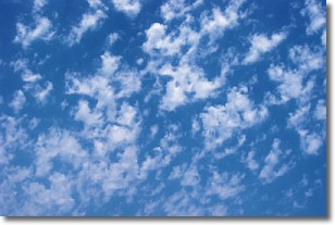
Weather Topic: What are Fractus Clouds?
Home - Education - Cloud Types - Fractus Clouds
 Next Topic: Freezing Rain
A fractus cloud (scud) is a fragmented, tattered cloud which has
likely been sheared off of another cloud. They are accessory clouds, meaning they
develop from parent clouds, and are named in a way which describes the original
cloud which contained them.
Fractus clouds which have originated from cumulus clouds are referred to as
cumulus fractus, while fractus clouds which have originated from stratus clouds
are referred to as stratus fractus. Under certain conditions a fractus cloud might
merge with another cloud, or develop into a cumulus cloud, but usually a
fractus cloud seen by itself will dissipate rapidly.
They are often observed on the leading and trailing edges of storm clouds,
and are a display of wind activity.
Next Topic: Freezing Rain
Weather Topic: What is Graupel?
Home - Education - Precipitation - Graupel
 Next Topic: Hail
Graupel is a form of precipitation that is created by atmospheric conditions
which cause supercooled water droplets to contact snow crystals and freeze to
their surface.
Sometimes known as soft hail or snow pellets, graupel is delicate and easily
destroyed by touch. Whereas hail usually falls during severe weather, graupel
doesn't require such conditions to form, and can form in mild precipitation
similar to situations which produce snowfall.
Next Topic: Hail
Current conditions powered by WeatherAPI.com


