Weather Alert in Minnesota
Winter Storm Watch issued February 15 at 2:32PM CST until February 19 at 12:00PM CST by NWS Duluth MN
AREAS AFFECTED: Koochiching; North St. Louis; Northern Cook/Northern Lake; North Itasca; Central St. Louis; North Cass; South Itasca; Northern Aitkin; Carlton/South St. Louis
DESCRIPTION: * WHAT...Heavy snow, patchy blowing snow, and mixed precipitation possible. There is a 50 to 90 percent chance for total snow accumulations in excess of 6 inches, highest for the higher terrain of the North Shore. There is also a 20 to 70 percent chance for at least a glaze of ice accumulations. Winds could gust as high as 35 mph. * WHERE...Northern Aitkin, Koochiching, North Cass, Itasca, Carlton, St. Louis, and Northern Cook and Lake Counties. This includes the Tribal Lands of the Fond du Lac Band, the Mille Lacs Band, Big Sandy Lake area and the Bois Forte Band, Nett Lake, Deer Creek and, Lake Vermilion areas. Other locations including Voyageurs National Park. The entire Boundary Waters is also included. * WHEN...From Tuesday evening through Thursday morning. * IMPACTS...Travel could be very difficult. The hazardous conditions could impact the Tuesday evening, Wednesday, and Thursday morning commutes. * ADDITIONAL DETAILS...Periods of gusty winds and visibility of less than one quarter mile are possible in the Winter Storm Watch area. The best potential for a wintry mix will be along and south of the Iron Range Tuesday evening into Wednesday morning.
INSTRUCTION: Monitor the latest forecasts for updates on this situation.
Want more detail? Get the Complete 7 Day and Night Detailed Forecast!
Current U.S. National Radar--Current
The Current National Weather Radar is shown below with a UTC Time (subtract 5 hours from UTC to get Eastern Time).

National Weather Forecast--Current
The Current National Weather Forecast and National Weather Map are shown below.

National Weather Forecast for Tomorrow
Tomorrow National Weather Forecast and Tomorrow National Weather Map are show below.

North America Water Vapor (Moisture)
This map shows recent moisture content over North America. Bright and colored areas show high moisture (ie, clouds); brown indicates very little moisture present; black indicates no moisture.

Weather Topic: What are Cumulus Clouds?
Home - Education - Cloud Types - Cumulus Clouds
 Next Topic: Drizzle
Cumulus clouds are fluffy and textured with rounded tops, and
may have flat bottoms. The border of a cumulus cloud
is clearly defined, and can have the appearance of cotton or cauliflower.
Cumulus clouds form at low altitudes (rarely above 2 km) but can grow very tall,
becoming cumulus congestus and possibly the even taller cumulonimbus clouds.
When cumulus clouds become taller, they have a greater chance of producing precipitation.
Next Topic: Drizzle
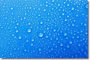
Weather Topic: What is Evaporation?
Home - Education - Precipitation - Evaporation
 Next Topic: Fog
Evaporation is the process which returns water from the earth
back to the atmosphere, and is another crucial process in the water cycle.
Evaporation is the transformation of liquid into gas, and it happens because
molecules are excited by the application of energy and turn into vapor.
In order for water to evaporate it has to be on the surface of a body of water.
Next Topic: Fog
Current conditions powered by WeatherAPI.com


