Weather Alert in New York
Flood Warning issued March 9 at 7:24PM EDT until March 10 at 11:15AM EDT by NWS Albany NY
AREAS AFFECTED: Albany, NY; Saratoga, NY; Schenectady, NY
DESCRIPTION: * WHAT...Flooding caused by an ice jam continues. * WHERE...A portion of east central New York near the Mohawk River, including the following counties, Albany, Saratoga and Schenectady. * WHEN...Until 1115 AM EDT Tuesday. * IMPACTS...Flooding of low-lying areas near the Mohawk River is imminent or occurring. * ADDITIONAL DETAILS... - At 722 PM EDT, gauge reports and webcams indicated an ice jam is occurring along the Mohawk River between the Rexford Bridge and the Crescent Bridge. This ice jam will continue to have the potential to cause flooding through Tuesday morning. - Some locations that may experience flooding include... Cohoes, Alplaus, East Glenville, Halfmoon, Vischer Ferry, Mohawk View, Groom Corners, Grays Corners, Dunsbach Ferry, Crescent Station, Crescent, Aqueduct and Rexford. - http://www.weather.gov/safety/flood
INSTRUCTION: Turn around, don't drown when encountering flooded roads. Most flood deaths occur in vehicles. Please report flooding to the National Weather Service by email at ALB.stormreport@noaa.gov... On Facebook at www.facebook.com/nwsalbany or twitter @nwsalbany.
Want more detail? Get the Complete 7 Day and Night Detailed Forecast!
Current U.S. National Radar--Current
The Current National Weather Radar is shown below with a UTC Time (subtract 5 hours from UTC to get Eastern Time).

National Weather Forecast--Current
The Current National Weather Forecast and National Weather Map are shown below.

National Weather Forecast for Tomorrow
Tomorrow National Weather Forecast and Tomorrow National Weather Map are show below.

North America Water Vapor (Moisture)
This map shows recent moisture content over North America. Bright and colored areas show high moisture (ie, clouds); brown indicates very little moisture present; black indicates no moisture.

Weather Topic: What is Evaporation?
Home - Education - Precipitation - Evaporation
 Next Topic: Fog
Evaporation is the process which returns water from the earth
back to the atmosphere, and is another crucial process in the water cycle.
Evaporation is the transformation of liquid into gas, and it happens because
molecules are excited by the application of energy and turn into vapor.
In order for water to evaporate it has to be on the surface of a body of water.
Next Topic: Fog
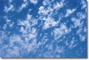
Weather Topic: What are Fractus Clouds?
Home - Education - Cloud Types - Fractus Clouds
 Next Topic: Freezing Rain
A fractus cloud (scud) is a fragmented, tattered cloud which has
likely been sheared off of another cloud. They are accessory clouds, meaning they
develop from parent clouds, and are named in a way which describes the original
cloud which contained them.
Fractus clouds which have originated from cumulus clouds are referred to as
cumulus fractus, while fractus clouds which have originated from stratus clouds
are referred to as stratus fractus. Under certain conditions a fractus cloud might
merge with another cloud, or develop into a cumulus cloud, but usually a
fractus cloud seen by itself will dissipate rapidly.
They are often observed on the leading and trailing edges of storm clouds,
and are a display of wind activity.
Next Topic: Freezing Rain
Current conditions powered by WeatherAPI.com


