Weather Alert in Colorado
High Wind Watch issued February 15 at 11:10PM MST until February 17 at 5:00PM MST by NWS Denver CO
AREAS AFFECTED: Northeast Weld County; Morgan County; Central and East Adams and Arapahoe Counties; Logan County
DESCRIPTION: * WHAT...West winds 30 to 40 mph with gusts up to 65 mph possible. * WHERE...Briggsdale, Fort Morgan, Byers, and Sterling. * WHEN...From Tuesday morning through Tuesday afternoon. * IMPACTS...Gusty winds will blow around unsecured objects and a few power outages may result. Strong winds will likely lead to rapid fire growth of any new fire. Blowing dust may reduce visibility to less than a quarter mile in places.
INSTRUCTION: Fasten loose objects or shelter objects in a safe location prior to the onset of winds. Winds this strong can make driving difficult, especially for high profile vehicles. Use extra caution. Avoid outdoor burning or any activity that may cause sparks. The strong winds will likely fuel rapid fire growth.
Want more detail? Get the Complete 7 Day and Night Detailed Forecast!
Current U.S. National Radar--Current
The Current National Weather Radar is shown below with a UTC Time (subtract 5 hours from UTC to get Eastern Time).

National Weather Forecast--Current
The Current National Weather Forecast and National Weather Map are shown below.

National Weather Forecast for Tomorrow
Tomorrow National Weather Forecast and Tomorrow National Weather Map are show below.

North America Water Vapor (Moisture)
This map shows recent moisture content over North America. Bright and colored areas show high moisture (ie, clouds); brown indicates very little moisture present; black indicates no moisture.

Weather Topic: What is Rain?
Home - Education - Precipitation - Rain
 Next Topic: Shelf Clouds
Precipitation in the form of water droplets is called rain.
Rain generally has a tendency to fall with less intensity over a greater period
of time, and when rainfall is more severe it is usually less sustained.
Rain is the most common form of precipitation and happens with greater frequency
depending on the season and regional influences. Cities have been shown to have
an observable effect on rainfall, due to an effect called the urban heat island.
Compared to upwind, monthly rainfall between twenty and forty miles downwind of
cities is 30% greater.
Next Topic: Shelf Clouds
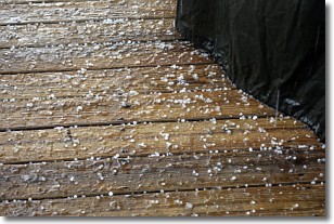
Weather Topic: What is Sleet?
Home - Education - Precipitation - Sleet
 Next Topic: Snow
Sleet is a form of precipitation in which small ice pellets are the primary
components. These ice pellets are smaller and more translucent than hailstones,
and harder than graupel. Sleet is caused by specific atmospheric conditions and
therefore typically doesn't last for extended periods of time.
The condition which leads to sleet formation requires a warmer body of air to be
wedged in between two sub-freezing bodies of air. When snow falls through a warmer
layer of air it melts, and as it falls through the next sub-freezing body of air
it freezes again, forming ice pellets known as sleet. In some cases, water
droplets don't have time to freeze before reaching the surface and the result is
freezing rain.
Next Topic: Snow
Current conditions powered by WeatherAPI.com


