Weather Alert in Oregon
Winter Storm Warning issued February 17 at 12:03PM PST until February 19 at 10:00AM PST by NWS Medford OR
AREAS AFFECTED: Central Douglas County
DESCRIPTION: * WHAT...For the Winter Weather Advisory below 1500 ft, wet snow. Additional snow accumulations up to 3 inches. For the Winter Storm Warning above 1500 ft, heavy snow. Additional snow accumulations 3 to 6 inches, except up to 10 inches above 2500 ft. * WHERE...For the Winter Weather Advisory below 1500 ft, this includes Roseburg, Elkton, Sutherlin, Camas Valley and Canyonville as well as portions of I-5, including Roberts Mountain Pass, and Highways 42 and 138. For the Winter Storm Warning above 1500 ft, this includes Glendale and Tiller as well as portions of I-5 south of Canyonville and Canyon Creek Pass on I-5 around 2000 ft. * WHEN...Until 10 AM PST Thursday. * IMPACTS...Travel may be very difficult to impossible. The hazardous conditions could impact the evening and morning commutes. * ADDITIONAL DETAILS...Precipitation will be lighter and more showery tonight into Wednesday with mostly light accumulations. Wet, slushy roads could turn icy. Another round of heavier snowfall is expected Wednesday night into Thursday. Visit weather.gov/mfr/winter for additional snow probabilities.
INSTRUCTION: If you must travel, keep an extra flashlight, food, and water in your vehicle in case of an emergency. Call 511 or visit tripcheck.com for road information. Slow down and use caution while traveling. Call 511 or visit tripcheck.com for road information.
Want more detail? Get the Complete 7 Day and Night Detailed Forecast!
Current U.S. National Radar--Current
The Current National Weather Radar is shown below with a UTC Time (subtract 5 hours from UTC to get Eastern Time).

National Weather Forecast--Current
The Current National Weather Forecast and National Weather Map are shown below.

National Weather Forecast for Tomorrow
Tomorrow National Weather Forecast and Tomorrow National Weather Map are show below.

North America Water Vapor (Moisture)
This map shows recent moisture content over North America. Bright and colored areas show high moisture (ie, clouds); brown indicates very little moisture present; black indicates no moisture.

Weather Topic: What are Cumulus Clouds?
Home - Education - Cloud Types - Cumulus Clouds
 Next Topic: Drizzle
Cumulus clouds are fluffy and textured with rounded tops, and
may have flat bottoms. The border of a cumulus cloud
is clearly defined, and can have the appearance of cotton or cauliflower.
Cumulus clouds form at low altitudes (rarely above 2 km) but can grow very tall,
becoming cumulus congestus and possibly the even taller cumulonimbus clouds.
When cumulus clouds become taller, they have a greater chance of producing precipitation.
Next Topic: Drizzle
Weather Topic: What is Evaporation?
Home - Education - Precipitation - Evaporation
 Next Topic: Fog
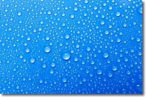
Evaporation is the process which returns water from the earth
back to the atmosphere, and is another crucial process in the water cycle.
Evaporation is the transformation of liquid into gas, and it happens because
molecules are excited by the application of energy and turn into vapor.
In order for water to evaporate it has to be on the surface of a body of water.
Next Topic: Fog
Current conditions powered by WeatherAPI.com


